
I first came across tactile maps in grad school under Professor Amy Lobben, and the Spatial and Map Cognition Research Lab. As part of one of Amy's classes we designed tactile maps for the University of Oregon campus. Tactile maps are raised to form a touchable surface, and often incorporate braille annotations. They are used by the visually impaired and blind. Throughout this trip I've seen some great examples of aides used to help visually impaired people to explore a historical site.
While in Carcassonne, I wandered into a gift shop, and I saw a beautiful book on the city, full of tactile maps and illustrations. La Cité de Carcassonne is written by Claude Marti and Illustrated by Jean-Pierre Suaut and Hoëlle Corvest. Corvest is the expert in tactile design, Suaut in medieval history and illustration. You can find the book on the French version of Amazon here, but at least for the moment it looks like it is out of stock. The book itself is large, but fairly light, the pages some sort of soft plastic material. The difficulty with creating these kinds of books involves the tension between including too much information, and not enough. Scale is often distorted in order to allow users to distinguish between symbols. The size of lines, the density of points, the variability of symbols, all need to be designed to be most usable for the visually impaired. Simple for readability, yet data rich. Difficult.
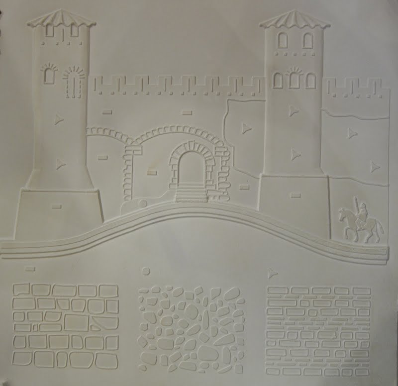
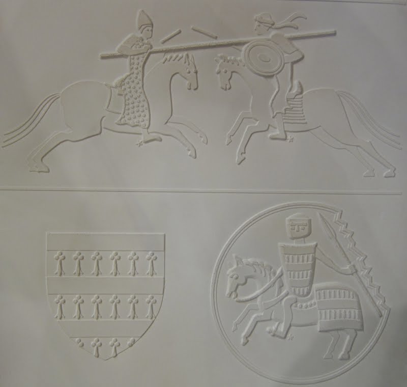
This book used 60 embossed images to help explore Carcassone and its history. There is an accompanying CD that talks in depth about the history, accompanying each image.
Maps were used to help set the context of the location using a variety of scales. Political maps showing the location of cities within the Mediterranean region of Europe and Northern Africa, physical maps showing Carcassone's location within the watershed, maps of France showing physical and cultural features, and maps of the city itself, and plans of buildings.


In addition to the beautiful cartography, it helped to explore the architecture of Carcassonne, looking at the buildings themselves, building techniques, adornments such as columns, statues, gargoyles, and stained glass.


It also showed defensive practices, military techniques, and symbols.

A beautiful book, I'd love to know how readable visually impaired people find it, and if any studies have been done to determine the positives and negatives of its design. Studies of tactile map design have been going on in geography departments and spatial cognition labs for some time, and as more is learned, better (and more affordable) maps will be able to be produced for those that need them. Always important to think about how we can improve experiences for everyone.
Fascinating illustrations, Mary, and very clear photographs. I wonder what inspired the authors to "write" the book.
ReplyDeleteYeah, it was really cool. I have no idea, because whatever there was for information was written in Braille. Cool project, though. Would be fun to do that for all sorts of historic sites! :) hmmmm.
ReplyDelete